We hope everyone's bought their last minute bits, because Storm Eva and her forecasted gales of 120km/h may hamper your Christmas shopping somewhat - not to mention added worry for those still recovering from Storm Desmond.
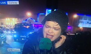
Yesterday, we learned that Storm Eva was on her way across the Atlantic. Now Met Eireann have more detail involving the duration and strength of the winds. She's set to make landfall on the West properly this afternoon, but those shores are probably feeling effects already. There is a Status Orange Wind Warning in place for Donegal, Galway, Mayo, Sligo and Clare, starting at 1pm today and lasting until midnight tonight.
Meanwhile, There is a Yellow Warning in place for Leinster, Cavan, Monaghan, Leitrim, Roscommon, Cork, Kerry, Limerick, Tipperary and Waterford.

Forecaster Joanna Donnelly from Met Eireann told Ireland AM that those residing close to coastlines will have to prepare themselves for "very strong winds". Rain will be heavy and hit late this evening, moving quickly overnight tonight.
On top of that, you may have noticed the temperatures have plummeted somewhat. Tomorrow is said to be particularly cold, with temperatures much more seasonal for this time of year - around 3 degrees Cent. They've even suggested that there might be some wintry showers in store for Donegal Christmas morning.
As 'F' is next on the list of storm names, We propose that the next one to make landfall is called FECKOFFWOULDYA!